WAINFLEET
Historic Background
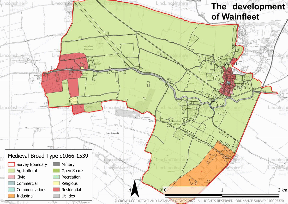
The Historic Environment Record does not document any prehistoric finds or features within the survey boundary. During this period, the area in which Wainfleet would later be established was within an area of dry bed marine silt and clay fenland. Wainfleet was long believed to have been the site of a Roman settlement, known as Vainona. This was based upon the hypothesis of the 18th century antiquarian William Stukeley although no finds have been made to support this theory. As a result the theory is now largely discounted. Salt making was present in the wider area during the Roman period, although there is only limited evidence of any Roman activity within the survey area itself to indicate the presence of settlement. Evidence from the early medieval period is equally as limited. By the Domesday survey there is clear evidence of numerous farmsteads or estates. By the medieval period the settlements of Wainfleet All Saints and Wainfleet St Mary had been established, although both were situated to the western extent of the survey area, higher up the Steeping River. Both of the settlements moved, possibly during the 14th or 15th century, and the sites of the former villages are now recorded in the HER as deserted medieval villages.


The layout of Wainfleet All Saints appears to have been planned around the central market at this time. Salt making was the principal industry of medieval Wainfleet and the remains of the process are seen to the south of the survey area. Wainfleet was also a prominent port during the medieval period, the Steeping River being considered a safe harbour. Its success began to wane during the 15th century, due to silting of the Steeping and Boston increasing in importance. As a result, the town began to decline economically. Despite this, Magdalen College was founded in the town in the later 15th century, with the aim that scholars would be trained here for enrolment at Oxford University. This building remained in use as a school for the following centuries, although it is now in use as a library and museum. By the post-medieval period, the town’s main focus had become agriculture, and much of the surrounding land was used for arable or grazing, the salt marsh being particularly suited for livestock.
In 1563 Wainfleet All Saints had approximately 56 households and Wainfleet St Mary had 38. By 1801, the population of Wainfleet All Saints, St Mary and St Thomas stood at 983 and rose steadily during this century to 1902, as recorded in 1901. The focus of the settlements remained largely within the layout which had been established in the preceding centuries, although during the 18th and 19th centuries, new public buildings, amenities, churches and farmsteads were also established. Wainfleet was also connected to the railway network during the 19th century and the Wainfleet to Firsby railway line opened by 1871. A further line was opened in 1873 connecting Wainfleet to the rising seaside town of Skegness. The modern period has seen the growth of both Wainfleet All Saints and Wainfleet St Mary. Housing developments have taken place on most sides of the settlement, although most of these remain small. Bateman’s Brewery, located on the River Steeping, is one of the largest industries in Wainfleet, although agriculture continues to be a significant source of employment in the surrounding area.
Character Summary
The historic character of Wainfleet is largely held within Wainfleet All Saints. Its character, which is recorded in HUCA 1 is one of small scale, red brick and render buildings. The street layout is a remnant of the town’s development during the medieval period with a planned central market place surrounded by medieval property boundaries. Today the buildings in this area range from the medieval to the modern period, although the development which has taken place in the 20th and 21st centuries has largely been sympathetic to that which had taken place in the medieval and post-medieval periods. The types of buildings, demonstrate the urban growth of the town, with farmsteads and public houses more common during the post-medieval period and housing seen in increasing numbers in the modern period. The character area is tightly packed with terraced buildings common in the town centre and infilling in areas behind the street frontage. Residential growth also occurred outside of the medieval core in the modern period with the development of new housing estates. These are captured in HUCA 2, the character of this HUCA reflects national residential patterns rather than local vernacular. Development is medium to low density with houses often in single plots with driveways and gardens. The housing seen in this HUCA is mixed, and comprised of detached, semi-detached, short terraces and bungalows and uses modern materials including concrete tile roofs and uPVC windows.